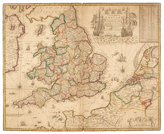
1673 MORDEN, Robert
Robert Morden (fl.1669-1703) was a leading
English mapmaker, mapseller, globemaker, engraver and publisher from the last
quarter of the eighteenth century; his place and date of birth are not known,
but it is thought he came from the West Riding of Yorkshire. He was probably
apprenticed to Joseph Moxon, who was born in Wakefield, Yorkshire, in the
Weavers' Company, and made free by about 1666.
In 1673 he published a rare separately issued map of England and Wales, engraved by Francis Lamb. To the upper right the title is flanked by two large ships and several smaller vessels, a motif used again in 1690 (cf). The first state is largely assumed on the evidence of advertisements placed by Morden in the Term Catalogue and the London Gazette. The latter announces the map is to be sold by Morden with Arthur Tooker and Robert Greens. The first example known of this map is dated 1675 and bears only the imprint of Morden and Greene.[1] Shows two roads in the West: Exeter, Plymouth to Sennan and Exeter to Barnstable.
A New Map of England
Containing the Adjacent parts of Scotland, Ireland, France, Flanders and
Holland ... with a description of the Post Roads and their several branches from
town to Town never before extent, by R Morden at the Atlas in Cornhill. F Lamb
Sculp. (BL, B, NLS)
A single sheet sold jointly by Morden, Tooker and Robert Greene. Size: 445 x 560 mm.
A 2nd state was issued post
mid-1675, with the imprint of Morden & Greene.
A 3rd state c.1690 omitting reference to Morden (illustrated).

Comments
Post a Comment